This data catalog has been developed as part of the EU-ACP Programme “Building Disaster Resilience to Natural Hazards in Sub-Saharan African Regions, Countries and Communities”.
It contains a series of geographic layers which can be freely accessed and downloaded.
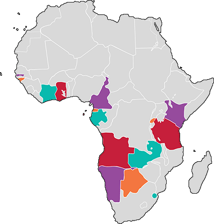
Within the framework of the Programme, CIMA Research Foundation has been engaged by UNDRR to elaborate 16 Country Risk Profiles for floods and droughts in the following countries:
Click to search for geospatial data published by other users, organizations and public sources. Download data in standard formats.
Data is available for browsing, aggregating and styling to generate maps which can be saved, downloaded, shared publicly or restricted to specify users only.
As for the layers and maps GeoNode allows to publish tabular and text data, manage theirs metadata and associated documents.
Geonode allows registered users to easily upload geospatial data and various documents in several formats.