- Title
- Ward Boundaries of Zambia
- Abstract
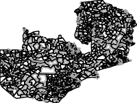
This feature represents the wards of the Republic of Zambia. Wards are delineated by the Electoral Commission of Zambia (ECZ) and the Central Statistics of Zambia (CSO) for the purpose of the population and housing census and elections.
wards are delineated once in a decade during the census mapping exercise.
Source: Electoral Commission of Zambia (ECZ) and the Central Statistics of Zambia (CSO)
- License
- Not Specified
-
+ The original author did not specify a license.
- Publication Date
- Jan. 21, 2020, 2:51 a.m.
- Type
- Vector Data
- Keywords
- features popward
- Category
- Boundaries
- legal land descriptions. Examples: political and administrative boundaries
- Regions
- Global, Africa, Southern Africa, Zambia
- Approved
- Yes
- Published
- Yes
- Featured
- No
- Group
- RISK PROFILES
- Name
- Michael Phiri (michael.phiri)
- Position
- Organization
- Zambia
- Location
- Voice
- Fax
- Identification Image
-
- Spatial Extent
- ---
- Projection System
- EPSG:4326
- Extension x0
- 21.998040875000100
- Extension x1
- 33.708576224000100
- Extension y0
- -18.075164000000000
- Extension y1
- -8.224359999999930
- Restrictions
- formal permission to do something
- Language
- English
- Data Quality
- The data is created and supplied by the ECZ and the CSO who are the mandated institutions.
- Supplemental Information
No information provided
- Name
- Michael Phiri (michael.phiri)
- Position
- Organization
- Zambia
- Location
- Voice
- Fax
- Link Online
- /layers/geonode:popward
- Metadata Page
- /layers/geonode:popward/metadata_detail
- JPEG
- Ward Boundaries of Zambia.jpg
- Ward Boundaries of Zambia.pdf
- PNG
- Ward Boundaries of Zambia.png
- Zipped Shapefile
- Ward Boundaries of Zambia.zip
- GML 2.0
- Ward Boundaries of Zambia.gml
- GML 3.1.1
- Ward Boundaries of Zambia.gml
- CSV
- Ward Boundaries of Zambia.csv
- Excel
- Ward Boundaries of Zambia.excel
- GeoJSON
- Ward Boundaries of Zambia.json
- KML
- Ward Boundaries of Zambia.kml
- View in Google Earth
- Ward Boundaries of Zambia.kml
- Remote Thumbnail
- Ward Boundaries of Zambia.png
- Thumbnail
- Ward Boundaries of Zambia.png
- Legend
- Ward Boundaries of Zambia.png
- OGC WMS: geonode Service
- Geoservice OGC:WMS
- OGC WFS: geonode Service
- Geoservice OGC:WFS
- Name
- Michael Phiri (michael.phiri)
- Position
- Organization
- Zambia
- Location
- Voice
- Fax