- Title
- Zambia_main_road_network
- Abstract
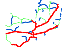
The dataset provides the main roads in Zambia. These roads are managed by the Road Development Agency (RDA). The shapefile includes trunk, primary and secondary roads. The names and the codes of the roads are also provided. It also indicates whether a tunnel and/or bridge are present on a road.
Source: National Remote Sensing Centre (NRSC)
- License
- Not Specified
-
+ The original author did not specify a license.
- Publication Date
- Jan. 21, 2020, 7:20 a.m.
- Type
- Vector Data
- Keywords
- features main_road_network_zam roads
- Category
- Transportation
- means and aids for conveying persons and/or goods. Examples: roads, airports/airstrips, shipping routes, tunnels, nautical charts, vehicle or vessel location, aeronautical charts, railways
- Regions
- Africa, Southern Africa, Zambia
- Approved
- Yes
- Published
- Yes
- Featured
- No
- Group
- RISK PROFILES
- Name
- Michael Phiri (michael.phiri)
- Position
- Organization
- Zambia
- Location
- Voice
- Fax
- Identification Image
-
- Spatial Extent
- ---
- Projection System
- EPSG:4326
- Extension x0
- 22.097529439068300
- Extension x1
- 33.481164400000000
- Extension y0
- -17.929479200000000
- Extension y1
- -8.467039518397520
- Restrictions
- No restrictions
- Purpose
Provides road infrastructure for Zambia
- Language
- English
- Data Quality
- The data was provided to the National Remote Sensing Centre (NRSC) by the Road Development Agency (RDA) of Zambia.
- Supplemental Information
No information provided
- Name
- Michael Phiri (michael.phiri)
- Position
- Organization
- Zambia
- Location
- Voice
- Fax
- Link Online
- /layers/geonode:main_road_network_zam
- Metadata Page
- /layers/geonode:main_road_network_zam/metadata_detail
- JPEG
- Zambia_main_road_network.jpg
- Zambia_main_road_network.pdf
- PNG
- Zambia_main_road_network.png
- Zipped Shapefile
- Zambia_main_road_network.zip
- GML 2.0
- Zambia_main_road_network.gml
- GML 3.1.1
- Zambia_main_road_network.gml
- CSV
- Zambia_main_road_network.csv
- Excel
- Zambia_main_road_network.excel
- GeoJSON
- Zambia_main_road_network.json
- KML
- Zambia_main_road_network.kml
- View in Google Earth
- Zambia_main_road_network.kml
- Remote Thumbnail
- Zambia_main_road_network.png
- Thumbnail
- Zambia_main_road_network.png
- Legend
- Zambia_main_road_network.png
- OGC WMS: geonode Service
- Geoservice OGC:WMS
- OGC WFS: geonode Service
- Geoservice OGC:WFS
- Name
- Michael Phiri (michael.phiri)
- Position
- Organization
- Zambia
- Location
- Voice
- Fax