- Thumbnail
- Resource ID
- bdf1f406-3c50-11ea-85eb-02f25c5c7296
- Title
- Zambia_main_road_network
- Date
- Jan. 21, 2020, 7:20 a.m., Publication
- Abstract
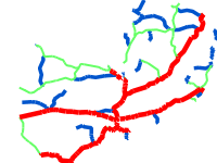
- The dataset provides the main roads in Zambia. These roads are managed by the Road Development Agency (RDA). The shapefile includes trunk, primary and secondary roads. The names and the codes of the roads are also provided. It also indicates whether a tunnel and/or bridge are present on a road.
Source: National Remote Sensing Centre (NRSC)
- Edition
- --
- Owner
- michael.phiri
- Point of Contact
- Phiri
- Purpose
- Provides road infrastructure for Zambia
- Maintenance Frequency
- None
- Type
- not filled
- Restrictions
- formal permission to do something
- No restrictions
- License
- Not Specified
- Language
- eng
- Temporal Extent
- Start
- --
- End
- --
- Supplemental Information
- No information provided
- Data Quality
- The data was provided to the National Remote Sensing Centre (NRSC) by the Road Development Agency (RDA) of Zambia.
- Extent
-
- long min: 22.097529439068300
- long max: 33.481164400000000
- lat min: -17.929479200000000
- lat max: -8.467039518397520
- Spatial Reference System Identifier
- EPSG:4326
- Keywords
- no keywords
- Category
- Transportation
- Regions
-
Africa
,
Southern Africa
,
Zambia